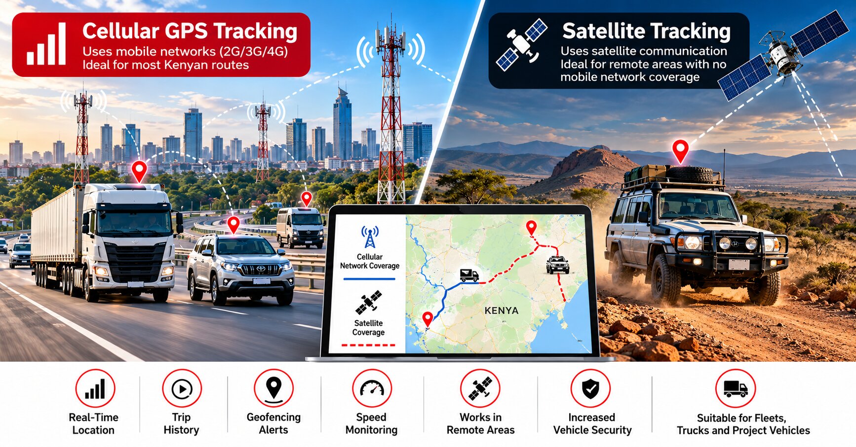
A vehicle may travel comfortably from Nairobi to major towns while remaining visible on a GPS tracking platform, then suddenly stop updating after entering a remote project area. This does not necessarily mean the GPS tracker has failed. Most conventional vehicle trackers use satellite navigation to calculate their position but depend on a mobile network to transmit that location to the tracking server. Teltonika, for example, describes its GNSS trackers as collecting coordinates and sending them to a server through GSM or LTE connectivity. Understanding this distinction is important when comparing cellular GPS tracking and satellite tracking in Kenya.
For most private motorists and commercial fleets operating on established Kenyan routes, cellular GPS tracking remains the practical choice. Kenya’s Communications Authority reported in February 2026 that nearly 98 percent of the population was covered by 4G networks, although the regulator continues working to address remaining connectivity gaps. Population coverage does not mean every kilometre of land has uninterrupted signal, particularly in sparsely populated areas. A vehicle travelling through remote northern regions, conservancies, mining areas or isolated project locations can therefore encounter places where mobile data communication is temporarily unavailable.
A conventional tracker may still be able to determine its position during a mobile-network outage because GNSS and cellular communication perform different functions. The GNSS receiver works out where the vehicle is, while the cellular modem sends that information to the tracking platform. Some tracking devices can store records when communication is unavailable and transmit them after the network returns, depending on the device configuration. The fleet manager may therefore see an older location temporarily and later receive additional trip history once communication resumes.
Satellite-connected tracking becomes valuable when vehicles regularly operate beyond terrestrial mobile coverage. A combined solution can use the cellular network during normal operations and switch to satellite communication when mobile connectivity is unavailable. Teltonika documents such a configuration using compatible GPS trackers with an Iridium satellite modem, where data normally travels through the cellular network and satellite communication is used when terrestrial connectivity is unavailable. This type of arrangement can be relevant for remote logistics, exploration, cross-country expeditions and specialised projects where losing communication for long periods creates a serious operational or security risk.
Satellite connectivity, however, should not be confused with unlimited communication under every condition. Iridium states that its constellation offers global coverage, but many satellite devices require a sufficiently clear line of sight to the sky to communicate. A vehicle inside an underground basement, enclosed building or other obstructed environment may therefore struggle to communicate even when satellite technology is available. Installation position and antenna placement remain important, just as they do with conventional vehicle tracking systems.
Cost is another important difference. Cellular tracking normally makes sense for everyday fleets because mobile communication is widely available and relatively economical. Satellite hardware and communication services add additional equipment and connectivity costs, so installing satellite capability in every urban delivery van may provide little practical benefit. A logistics company operating mainly between Nairobi, Nakuru, Mombasa and other well-served corridors may have very different requirements from a business sending vehicles into remote regions where loss of mobile coverage could last for hours.
Fleet managers should therefore make the choice according to operational risk rather than technology alone. Ask where the vehicle travels, how frequently it enters areas without reliable mobile coverage, what cargo it carries and how serious it would be if management temporarily lost communication. A normal cellular GPS tracker may be entirely adequate for most Kenyan motorists and businesses. Higher-risk remote operations may justify a hybrid approach that uses affordable cellular communication whenever possible while retaining satellite connectivity as a backup when terrestrial networks disappear.
Finatrack Global Ltd provides professionally installed GPS tracking and fleet-management solutions for private motorists and commercial fleets in Kenya. Finatrack’s wired GPS tracker is available at KES 15,000, with location monitoring, trip history, geofencing and other features depending on the configured solution. Businesses operating vehicles in remote locations should discuss their routes and connectivity requirements before choosing a tracking setup so that the system matches the conditions in which the vehicles actually operate. For enquiries, call or WhatsApp 0723 645 810 or visit www.finatrack.co.ke. Cellular tracking is usually the most practical solution for everyday operations, while satellite connectivity becomes valuable when reaching the vehicle matters most precisely where the mobile network ends.