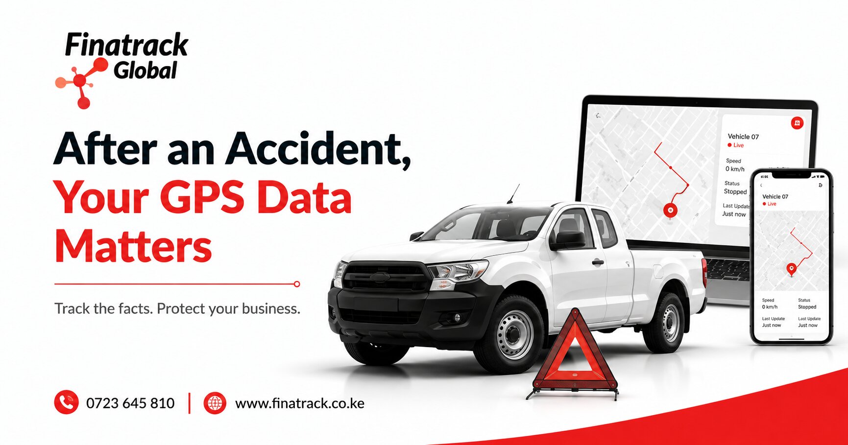
A road accident can turn an ordinary fleet journey into an investigation within minutes. Management may receive several different explanations from the driver, witnesses, another motorist or a customer, while the vehicle itself may already be on its way to a police station, garage or recovery yard. In the middle of that confusion, GPS tracking and telematics data can provide valuable information about where the vehicle was, how it travelled and what happened immediately before and after the incident.
For Kenyan businesses operating commercial fleets, this information can be particularly useful because managers are rarely present when accidents happen. A delivery truck may be hundreds of kilometres from head office, a sales vehicle may be travelling between customers or a company pickup may be operating at a remote project site. GPS data cannot automatically determine who caused the accident, but it can preserve important facts that help management reconstruct the journey more accurately.
The first priority after any accident should remain the safety of the people involved. Drivers and passengers should follow appropriate emergency procedures, seek medical assistance where necessary and notify the relevant authorities according to the circumstances. Fleet data becomes useful after immediate safety needs have been addressed, not as a replacement for them.
Once the situation is under control, one of the first pieces of information a fleet manager should check is the vehicle’s last reported location. This helps establish where the tracking system placed the vehicle around the time of the incident. The location can also assist management when coordinating recovery services, replacement transport or support staff.
The timestamp attached to that location is equally important. A vehicle icon appearing on a map does not necessarily mean the location is current because the tracker may have stopped communicating before or during the incident. Management should therefore record both the position and the exact last update time rather than saving a map screenshot without context.
Trip history can provide a broader view of the journey. Instead of looking only at the accident location, management can review where the vehicle started, which route it followed, where it stopped and how it approached the area where the incident occurred. This can help reconstruct events that drivers may struggle to remember accurately immediately after a stressful collision.
A driver may say that the vehicle had been travelling from Industrial Area towards Mombasa Road when the accident occurred, for example. The tracking history may support that explanation by showing the same route and direction of travel. If the records show something different, management has a reason to investigate further rather than relying entirely on memory.
GPS location information should nevertheless be treated carefully. A tracker provides vehicle movement data, but it does not automatically explain road conditions, lane position, right of way or the behaviour of other motorists. The information should therefore support an investigation rather than being presented as unquestionable proof of legal responsibility.
Speed information can be particularly important after an accident, but it also requires careful interpretation. Depending on the tracking system installed, the platform may show recorded vehicle speed at different points along the journey. This can help management understand whether the vehicle was moving slowly, travelling at normal road speed or recording unusually high speeds before the incident.
One speed reading should not automatically determine fault. GPS based speed data can be influenced by reporting intervals, device configuration and how often the tracker transmits information. The strongest analysis looks at several consecutive records and considers them alongside other evidence rather than focusing on one isolated number.
This is where the GPS update frequency becomes important. A tracker reporting every few seconds can provide a different level of journey detail from a device configured to transmit less frequently. Fleet managers should understand how their system records movement before treating the data as though it captures every second of the journey.
The platform may show that a vehicle was travelling at 80 km/h during one update and then stopped at the next recorded point, but this does not necessarily reveal the precise speed at the exact moment of impact. The collision may have occurred between those reports. GPS information therefore provides valuable context without automatically replacing specialised accident reconstruction.
Repeated speed patterns can still reveal important information. If tracking history consistently shows the vehicle travelling at high speed for several kilometres before the crash, that pattern may deserve closer examination. The fleet manager can then compare the information with driver statements, road conditions and any available video.
Harsh braking information can provide another clue where the telematics system supports it. A harsh braking event immediately before the accident may indicate that the driver attempted to avoid a collision or reacted suddenly to a hazard. It can also form part of a larger driving pattern requiring investigation.
The event itself does not explain why braking occurred. A pedestrian may have entered the road, another vehicle may have changed lanes unexpectedly or the driver may have been travelling too quickly for the conditions. Telematics can identify the event while other evidence provides the explanation.
Harsh acceleration records should be treated in the same way. They can show that a significant change in vehicle behaviour occurred but cannot automatically tell management why. Looking at the sequence of events around the accident is much more useful than reviewing each alert separately.
For businesses using AI dashcams or video telematics, the available evidence can be considerably richer. GPS data may show the location and movement of the vehicle, while video can provide visual context about road conditions, other vehicles and what occurred immediately before the impact. Together, the two sources can help management understand the incident more clearly.
Video should be preserved quickly because some systems overwrite older footage as storage fills. If an important accident clip remains only on local device storage, continued operation of the vehicle or camera may eventually replace it depending on the equipment. Fleet managers should understand how their dashcam stores and retrieves footage before an accident happens.
Where footage can be downloaded remotely, authorised staff should save the relevant period as soon as practical. It is usually sensible to preserve video from before, during and shortly after the incident rather than saving only the exact moment of impact. The minutes leading up to the accident may reveal information that is more valuable than the collision itself.
The same principle applies to trip records. Saving only the accident point can remove useful context about how the vehicle reached that location. A broader journey record may reveal earlier stops, route changes, speed patterns or unusual driver behaviour that management later needs to understand.
Fleet managers should therefore preserve the entire relevant journey where possible. This can include the trip start time, route history, recorded stops, location points and associated alerts. The amount of information required will depend on the seriousness of the incident and the purpose of the investigation.
The ignition record can also help establish a timeline. It may show when the vehicle began its journey, whether the engine remained active after the accident and when the vehicle was eventually switched off. This can become useful where several events occurred around the same period.
For example, a vehicle may collide with another car, remain running for several minutes and later be moved to a safer location. The trip history and ignition information can help explain why the final tracker position differs from the actual accident point. Without that context, somebody reviewing the map later could wrongly assume that the collision happened where the vehicle eventually stopped.
Vehicle movement after an accident therefore needs careful interpretation. Police officers, recovery operators or drivers may move the vehicle after the incident to clear the road or take it to another location. The latest location shown on the tracking platform may represent the recovery yard rather than the scene of the accident.
This is why the original accident location should be recorded separately whenever it can be established reliably. Fleet managers should not assume the last position on the platform automatically identifies where the collision occurred. Reviewing the sequence of movement usually provides a clearer picture.
A power disconnection alert can also appear after an accident. The collision may damage the vehicle battery, electrical wiring or tracker power supply, causing the device to lose external power. Depending on the hardware, the tracker may generate a notification before communication stops.
That alert does not necessarily indicate tampering. In an accident context, electrical damage, emergency battery isolation or workshop activity can provide perfectly legitimate explanations. The time of the power loss should be compared with the accident timeline before management decides what it means.
Where a tracker contains an internal backup battery, it may continue communicating temporarily after external power disappears. This can help preserve location information after the vehicle’s electrical system is damaged. The duration of backup operation varies according to the device, battery condition and configuration.
Businesses should understand this functionality before depending on it. Not every tracker has internal backup power, and an ageing backup battery may not perform the way it did when the device was new. Regular tracker health checks therefore support accident response as well as theft recovery.
Offline status after an accident also deserves attention. A tracker may stop communicating because of impact damage, power loss, poor network coverage or damage to its communication antenna. The last successful transmission can become particularly valuable when the device does not reconnect.
Management should record the last update time and location rather than repeatedly refreshing the application and assuming the information will return. If the vehicle later reconnects, additional stored data may become available depending on the tracker and configuration. The historical record should then be reviewed again.
For accidents occurring in areas with weak cellular coverage, an offline period may have nothing to do with the collision itself. The tracker may have already been experiencing communication gaps before the incident. Reviewing earlier journey records helps determine whether the loss of connectivity was unusual.
GPS data can also help establish how long the vehicle remained at the scene. A prolonged stationary period followed by movement to a police station, garage or recovery yard may create a useful timeline of events. This can assist internal fleet reporting even when it does not determine accident liability.
For companies with strict incident reporting procedures, the timeline can be compared with when the driver notified management. A significant delay between the vehicle stopping and the incident being reported may deserve explanation. The reason could still be completely legitimate, particularly if the driver was dealing with injuries or emergency services.
Management should therefore avoid using telematics data without considering the human circumstances of the accident. A driver involved in a serious collision may not immediately follow normal reporting procedures. Safety and medical needs should take priority over administrative compliance.
Fleet data can nevertheless help fill gaps later. People often remember stressful incidents imperfectly, and different witnesses may provide conflicting accounts. GPS history offers an independent record of vehicle movement that can be reviewed after everyone has had time to provide their statements.
Route history can become useful when determining whether the driver was operating within the expected assignment. A company van involved in an accident may have been travelling along the authorised delivery route, or the records may show that it had made an unexplained deviation before the incident. This information may be relevant to the business even if it does not affect legal responsibility for the collision.
A legitimate route deviation may have been caused by congestion, customer instructions or road closures. Managers should therefore compare the journey with operational records before deciding that the driver was using the vehicle improperly. The purpose is understanding the complete situation rather than searching for fault.
GPS tracking can also assist businesses when a vehicle is involved in an accident outside normal working hours. Management may first need to establish whether the journey itself was authorised. Trip and ignition history can help show when the vehicle began moving and where it travelled.
If employees are permitted to use company vehicles outside working hours, the organisation should already have a clear policy governing that use. Tracking information can then be interpreted according to those rules. Where personal use is prohibited, after-hours movement may require a separate internal investigation from the accident itself.
Another useful piece of information is the vehicle identifier shown on the tracking account. During an accident involving several company vehicles, management needs to ensure that the data being saved belongs to the correct registration number. Poorly maintained account labels can create serious confusion when reports are later reviewed.
Fleet administrators should keep registration numbers and vehicle names current. A tracker transferred from one vehicle to another should not remain labelled with the old registration. Accident data is only useful when management can confidently connect it to the correct asset.
The device identifier can also be recorded where relevant. If technical questions later arise about the tracker or reporting intervals, knowing which physical unit was installed can help the tracking provider review the correct equipment. This becomes more important across large fleets where several models of tracker may be in use.
Fleet managers should also consider data retention periods. Tracking platforms do not necessarily store trip history indefinitely, and the amount of time available can vary by provider and service arrangement. Waiting several months before trying to reconstruct a serious accident may result in information no longer being easily accessible.
Important incident data should therefore be exported or otherwise preserved as soon as reasonably practical. The business should not assume that because a journey can be seen in the application today it will remain available forever. Internal accident procedures can include a requirement to save relevant tracking data promptly.
Screenshots can be useful, but they should not be the only record where more complete exports are available. A screenshot captures what appeared on the screen at one moment and may exclude timestamps, route detail or other information. Downloaded reports or platform exports can provide a more structured record.
Where the business is involved in a serious claim or investigation, original records should be preserved carefully. Staff should avoid unnecessarily editing screenshots, changing timestamps or creating summaries that could later be mistaken for the original tracking data. Keeping the source material together with any internal analysis helps maintain clarity.
If management creates a written incident summary, it should distinguish between what the GPS platform recorded and what management concluded from it. For example, the platform may show that the vehicle travelled at a recorded speed shortly before the incident, while management may interpret this as unusually fast for the location. Those are two different statements and should not be confused.
This distinction becomes particularly important when information is provided to insurers, legal advisers or authorities. Raw tracking information should be presented accurately, while interpretation should remain clearly identified as interpretation. Overstating what GPS data proves can weaken rather than strengthen an investigation.
Insurance claims can benefit from good fleet documentation because the business may need to establish the circumstances surrounding the vehicle’s use. Tracking records can support the timeline, location and journey history while other documents establish policy details, driver authority and damage. The exact information required will depend on the circumstances and insurer.
GPS information should therefore complement photographs, police documentation, driver statements, witness information and repair assessments where relevant. No single source normally tells the entire accident story. A well managed fleet preserves several forms of information and allows them to be compared.
Photographs taken at the accident scene can be particularly valuable when combined with tracking data. GPS may establish the approximate location and time, while photographs show road position, damage and surrounding conditions. The two records answer different questions.
Dashcam footage can add another dimension by showing movement immediately before the collision. Where audio is recorded, businesses should also consider their privacy and data handling obligations when storing or sharing the footage. Access should remain limited to people with a legitimate reason to review the incident.
For fleets transporting passengers, accident records require particular care. Video, location and driver data may contain sensitive information about passengers or employees. The fact that the information exists does not mean it should be circulated widely across the organisation.
A clear internal accident response procedure can define who is allowed to access telematics and video. The fleet manager, safety manager, authorised senior management or other designated personnel may require the information, while most employees do not. Restricting access protects both the investigation and the people involved.
Companies should avoid forwarding accident footage casually through large WhatsApp groups. Once video leaves the controlled fleet system, copies can quickly spread and become difficult to manage. Serious incident data should be handled as business records rather than entertainment content.
Driver privacy should also remain part of the process. GPS tracking is installed primarily to manage company vehicles and operational risk, but accident investigations can reveal detailed employee movement. Organisations should use the information for legitimate fleet, safety, insurance or legal purposes rather than unrelated scrutiny.
The driver’s own statement remains important even where detailed telematics is available. Technology can show vehicle behaviour but cannot always show what the driver saw, heard or believed was happening. A complete investigation should therefore combine human explanation with vehicle data.
Suppose telematics shows a sudden harsh brake event immediately before impact. The driver may explain that a motorcycle entered the lane unexpectedly, while dashcam footage may support or contradict that explanation. GPS alone could not provide the same level of context.
This demonstrates why businesses should avoid treating telematics as an automatic disciplinary system. The data can identify events worthy of investigation, but management still needs to understand why they happened. Fair accident review improves both driver trust and road safety.
Patterns across several incidents can also become useful. One driver may repeatedly be involved in collisions preceded by overspeed alerts, while several different drivers may experience accidents at the same dangerous customer entrance. The first pattern may suggest driver coaching, while the second could indicate an operational route problem.
Fleet data therefore has value beyond individual accident investigations. Businesses can use incident records to identify recurring risk across the whole operation. The objective should be preventing future accidents rather than simply establishing what happened in the previous one.
Driver coaching can become more targeted when evidence is available. Instead of telling employees vaguely to drive more carefully, management can discuss recurring speeding, harsh braking or route issues supported by actual telematics. Drivers can then understand which behaviours need improvement.
Positive driving behaviour should also be recognised. A dashcam may show that a driver successfully avoided a much more serious accident through appropriate braking or steering. Telematics should not be used only to search for mistakes when it can also demonstrate responsible driving.
AI dashcams can support this approach through driver monitoring and road-facing video depending on the solution installed. The system may provide additional information about distraction, fatigue or road events. Businesses should select these features based on their real safety needs and use them transparently.
A serious accident can also expose whether the company’s tracking system itself was properly maintained. If management opens the platform and discovers that the vehicle has been offline for three months, valuable information may already be unavailable. Installing GPS hardware without monitoring device health creates false confidence.
Fleet managers should regularly check last update times across all vehicles. An offline tracker should be investigated while the vehicle is safely operating, not after an accident or theft creates an urgent need for data. Routine health checks protect the usefulness of the entire telematics system.
Trackers should also be checked after workshop visits, battery replacement or electrical repairs. A mechanic may accidentally disturb wiring, causing trip and ignition information to disappear even though the vehicle itself continues working normally. A simple post repair test can prevent long periods of missing data.
The same applies to dashcams. Memory cards, cameras and communication systems need to remain operational if video is expected to support future incidents. A camera that stopped recording months earlier cannot provide evidence simply because it remains mounted on the windscreen.
Businesses should periodically confirm that cameras are recording properly and that the date and time are correct. Incorrect timestamps can create confusion when matching video with GPS records. Synchronisation becomes especially important when several vehicles or cameras are involved in one incident.
Fleet managers should also know how to retrieve data before an accident occurs. Trying to learn the platform for the first time during a serious incident wastes valuable time. Staff responsible for fleet safety should know where trip history, alerts, reports and video can be found.
More than one authorised employee should understand the process. If the fleet manager is unavailable when an accident occurs, the company should still be able to preserve important information. Access should be secure but not dependent on one person’s memory or phone.
A simple accident data checklist can make the process more consistent. Management can preserve the latest vehicle position and timestamp, relevant trip history, recorded speeds, alerts, ignition information and available dashcam footage. The exact information will vary according to the system installed and seriousness of the incident.
The business should also record the time it retrieved the information. This helps distinguish the original event time from the later administrative process. Clear documentation becomes particularly useful when the accident leads to a long insurance or internal investigation.
GPS data may also support breakdown and recovery coordination after the collision. A damaged vehicle may need to be moved from an unfamiliar highway or rural road, and the tracker provides a location reference for the recovery operator. This can reduce the time spent trying to explain where the vehicle is.
Once the vehicle begins being towed, the tracking platform may show movement even though the ignition remains off. Management should not mistake this for unauthorised vehicle use. The recovery process should be documented so the later journey history can be interpreted correctly.
The same applies when a damaged car is loaded onto a transporter. The GPS device may continue changing location while the vehicle itself is not being driven. Ignition and movement records together can help distinguish this type of transport from normal operation.
A serious impact may also physically damage the tracker. If the unit stops reporting permanently, technicians can inspect it later when safe and appropriate. The business should avoid unnecessary dismantling before important incident information has been documented from the platform.
For high-value commercial vehicles, layered tracking can provide additional resilience. A backup wireless tracker or tag may continue providing location if the primary wired device is damaged or loses power. This can help during theft incidents following accidents or where a damaged vehicle is moved unexpectedly.
Accidents can occasionally occur in remote regions where the mobile network is weak. The tracker may record some information internally and upload it later when communication returns depending on the device. Fleet managers should therefore recheck the platform after connectivity has been restored.
A temporary gap in live data does not automatically mean no information exists. Historical records may become available later, and the tracking provider may be able to help interpret unusual device behaviour. Businesses should avoid finalising conclusions before checking whether additional data has synchronised.
For smaller companies, accident data management does not need to become complicated. The business can establish a basic procedure requiring the responsible manager to save trip information and any available video whenever a company vehicle is involved in a significant collision. The important point is consistency.
Larger fleets may benefit from a more formal incident management process. GPS information, dashcam footage, driver statements, repair reports and other evidence can be stored together under one incident reference. This creates a clearer history for safety reviews and insurance administration.
The strongest value comes when the organisation uses accidents as learning opportunities. If data repeatedly shows certain routes, times or driver behaviours are associated with incidents, management can change operations. The objective is to reduce the probability that the same type of accident happens again.
Route changes may sometimes produce better results than driver discipline. A particular junction may be difficult for large trucks, or deliveries may consistently be scheduled during the most congested and dangerous period of the day. GPS history can reveal the pattern while management determines the practical solution.
Vehicle condition should also remain part of the investigation. Tracking data cannot tell management whether tyres, brakes or steering components were mechanically defective unless specialised vehicle diagnostics are available. A proper mechanical inspection may therefore be essential after an accident.
Businesses should resist the temptation to make GPS responsible for questions it cannot answer. A tracker is excellent at recording movement, location and selected telematics events, but it is not a complete accident reconstruction system. Its strength lies in adding objective vehicle information to a broader investigation.
For that reason, fleet managers should understand the phrase supporting evidence. GPS information can support or challenge a driver’s explanation, help establish a timeline and identify important events, but liability may depend on many additional facts. Responsible use of the data preserves its credibility.
Finatrack Global Ltd provides professionally installed GPS tracking, fleet telematics and AI dashcam solutions for Kenyan businesses seeking greater visibility over vehicles and driver operations. Depending on the system installed, fleet managers can access location, trip history, selected driver behaviour information and video that can provide useful context when road incidents occur.
Professional installation can be arranged at the customer’s convenient location or through Finatrack Global Ltd at Vision Plaza, 1st Floor, Office 2, Mombasa Road, Nairobi. Businesses interested in improving fleet safety and incident visibility can contact 0723 645 810 or visit www.finatrack.co.ke to discuss an appropriate solution.
An accident may last only a few seconds, but the information surrounding it can remain valuable long afterwards. When fleet managers preserve location, timestamps, trip history, relevant alerts and available video promptly, they gain a clearer foundation for understanding what happened and improving what happens next. GPS data cannot decide who was at fault, but when it is properly preserved and interpreted, it can turn a confusing accident into a much more informed investigation.