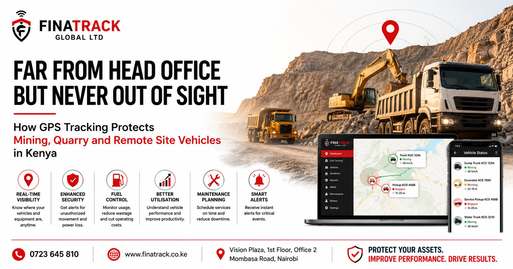
Mining, quarrying and remote project operations place vehicles and machinery in some of the most difficult environments for fleet management. Trucks may spend the day moving material between extraction points and processing areas, pickups may transport supervisors across large sites, while service vehicles and machinery can operate many kilometres from the company’s main office. Once these assets leave direct supervision, management needs a reliable way to understand where they are, how they are being used and whether unusual activity is occurring.
GPS tracking can provide that visibility by allowing authorised managers to monitor vehicles and selected equipment from a central platform. Depending on the system installed, businesses can access current or recently reported location, trip history, geofencing, ignition information and other operational data. For mining, quarry and remote site operations, this information can support security, utilisation, maintenance, fuel control and better coordination between headquarters and the field.
The need for visibility becomes especially important because remote operations are often spread across large geographical areas. A company may have trucks working inside a quarry, pickups travelling between sites and service vehicles transporting technicians or spare parts from the nearest town. Managing all these assets through phone calls alone can quickly become inefficient.
A site manager may know where vehicles are during the morning briefing, but that picture can change significantly within a few hours. One truck may leave for repairs, another may be reassigned to a different loading point and a supervisor vehicle may travel to another project location. GPS tracking gives management an updated operational picture without depending entirely on verbal reports.
Location monitoring is the most immediate benefit. A fleet manager can see whether a vehicle remains within the expected operating area, whether it is travelling between sites or whether it has stopped unexpectedly. This becomes particularly useful when vehicles operate in areas where road names and landmarks are limited.
A breakdown on a remote road can be difficult to describe accurately. A driver may only be able to say that the vehicle stopped several kilometres after a quarry entrance or near a particular village. GPS location gives the maintenance or recovery team a more precise starting point for coordinating assistance.
Faster breakdown response can reduce operational disruption. A truck that remains stranded for several hours may delay material movement, deliveries or other site activities. If management can identify the location quickly, mechanics, recovery vehicles or spare parts can be dispatched with less uncertainty.
GPS tracking also helps businesses understand how vehicles move within large sites. Quarry trucks may repeatedly travel between loading areas, crushers, stockpiles and disposal points throughout the day. Trip history can reveal whether the movement pattern matches the expected workflow or whether unnecessary journeys are increasing operating costs.
This can expose route inefficiencies that are difficult to notice from the office. A vehicle may be travelling a longer internal route because of poor allocation, site congestion or a temporary road change that has become permanent. Reviewing actual movement allows management to identify whether the operating layout can be improved.
Route optimisation matters because heavy commercial vehicles consume significant fuel. Even relatively small reductions in unnecessary distance can become valuable when repeated across several trucks every working day. The financial effect grows further when reduced mileage also lowers tyre wear, servicing requirements and general mechanical stress.
Geofencing can provide another important layer of control. Virtual boundaries can be created around a quarry, mine, project site, workshop, storage yard or other approved operating area. Depending on the tracking system, management can identify when vehicles enter or leave those zones.
This can be useful where vehicles are expected to remain on site for most of the week. A quarry truck leaving the approved operating area late at night may deserve immediate attention, while the same movement during a scheduled workshop transfer may be completely legitimate. GPS tracking makes the event visible so that management can verify the circumstances.
Unauthorised vehicle movement can create more than a security concern. A company truck used for work outside the project without approval can accumulate additional fuel costs, mileage and maintenance while exposing the business to unnecessary risk. When the vehicle operates far from management, such activity can remain unnoticed for long periods.
Trip history provides an independent movement record. Management can review when the vehicle left the site, where it travelled and when it returned. The information should still be interpreted within the operational context because legitimate assignments, emergency repairs and project requirements can explain unusual journeys.
Security remains one of the strongest reasons to track vehicles operating in remote areas. Pickups, trucks, generators and specialised machinery can represent substantial investments, and isolated sites may not always have the same security infrastructure available in major towns. GPS tracking provides an additional layer of asset visibility when vehicles are parked or operating far from headquarters.
An unexpected ignition event or movement outside normal operating hours can provide useful early information depending on the tracker installed. If a vehicle that should remain parked overnight suddenly becomes active, management can verify whether authorised personnel are using it. Early awareness can reduce the time between unusual activity and the company’s response.
Power disconnection alerts can also provide valuable context. If the tracker’s normal external power disappears unexpectedly, the business may need to determine whether maintenance is taking place, the vehicle battery has developed a problem or somebody is interfering with the tracking system. One alert should not automatically be treated as theft, but the surrounding events can help determine how serious the situation is.
Higher value assets may justify layered security. A wired GPS tracker can provide primary monitoring, while a separate wireless tracker or tracking tag can create an additional recovery layer if the main device is interfered with. Alarms and immobilisation systems may also be appropriate for selected vehicles depending on operational risk.
Using multiple security technologies reduces dependence on one device. A thief who discovers a wired tracker should not necessarily be able to remove every source of vehicle visibility at the same time. Layered security is particularly valuable where replacement of a vehicle or machine would create substantial financial and operational disruption.
Network coverage is an important consideration for mining, quarry and remote site operations. GPS satellite positioning and mobile network communication perform different functions in many vehicle tracking systems. A tracker may still determine where the vehicle is while temporarily being unable to transmit the information to the monitoring platform.
This can happen where vehicles operate in remote areas with weak cellular coverage. The tracking application may show an older location until communication is restored, which makes the last update time particularly important. Managers should always consider how recent the information is before assuming that the vehicle remains at the position shown.
Depending on the tracking equipment and configuration, journey records may be stored during periods of poor communication and transmitted later when the device reconnects. This can allow historical trip information to become available even though live visibility was temporarily interrupted. Businesses operating remote fleets should discuss this behaviour with their tracking provider before deployment.
A temporary network gap should therefore not automatically be interpreted as tracker failure. If the device repeatedly loses communication in the same remote section and returns online when the vehicle reaches stronger coverage, the pattern may be environmental. A tracker that remains offline after returning to a normally well covered location deserves technical investigation.
Fuel management is another major concern for remote fleets. Mining and quarry vehicles can consume large amounts of diesel, and fuel may be stored or dispensed at sites far from the company’s main office. This creates a management challenge because fuel expenditure can rise rapidly without management immediately understanding why.
GPS information provides useful context by showing how much vehicles are moving and where they are operating. If a truck’s fuel consumption increases significantly while its working pattern remains similar, management has a reason to investigate further. Mechanical condition, idling, driver behaviour, unnecessary journeys or fuel losses may all be contributing factors.
For operations requiring deeper visibility, dedicated fuel monitoring can be added where suitable. Depending on the equipment and tank configuration, fuel sensors can help track refilling activity and changes in fuel level. When combined with GPS movement, the business gains a clearer picture of how fuel is being consumed.
Fuel receipts alone cannot explain whether a truck worked intensively, spent long periods idling or made unnecessary trips. Telematics information fills part of that gap. This becomes especially valuable when managers are responsible for several sites and cannot physically inspect every vehicle each day.
Idling deserves particular attention in mining and quarry environments. Trucks may spend significant time waiting to load, queueing at crushers, waiting at weighbridges or remaining stationary while site traffic clears. Some of this is unavoidable, but repeated excessive waiting can consume fuel and reduce productivity.
GPS and ignition information can help management understand where these delays occur. If several trucks repeatedly spend long periods at one loading point, the issue may not be driver behaviour at all. The operating process itself may require improvement.
This is where fleet tracking moves beyond vehicle surveillance and becomes a management tool. The data can expose bottlenecks in site operations, allowing managers to investigate whether loading equipment, dispatching procedures or road layout are responsible. Reducing waiting time can improve both fuel efficiency and daily production.
Vehicle utilisation is equally important. A mining or quarry company may own several trucks while some units remain idle for substantial parts of the week. At the same time, other vehicles may be operating continuously and accumulating wear much faster.
Tracking information can help management understand which assets are carrying the greatest workload. This provides a basis for redistributing vehicles between sites or adjusting assignments before purchasing additional units. Better utilisation can help businesses obtain more value from existing assets.
The opposite conclusion can also support expansion. If tracking records show that every suitable vehicle is operating intensively and production is still constrained by transport capacity, management has stronger evidence that additional vehicles may be justified. Capital expenditure can then be based on actual operating information rather than assumptions.
Maintenance planning becomes critical under these conditions. Remote site vehicles often operate in dust, rough terrain and demanding environments that can accelerate wear. A truck working continuously in a quarry should not necessarily be maintained according to the same assumptions as a company vehicle used mainly on paved roads.
Mileage and utilisation information provide management with a clearer picture of how heavily each vehicle is working. Vehicles accumulating distance rapidly can be scheduled for service before maintenance becomes overdue. More accurate planning can reduce the risk of preventable breakdowns during critical operations.
Managers should also consider that mileage may not tell the entire story. Some site vehicles cover relatively short distances while spending many hours operating under heavy loads, climbing gradients or idling during loading. The mechanical workload can therefore be substantial even when kilometres appear modest.
Telematics data should be combined with manufacturer maintenance recommendations, engine hours where available and professional mechanical inspections. GPS information supports maintenance planning, but it should not replace proper technical assessment. The strongest maintenance programme uses several sources of information together.
Tyre management is another major cost area for quarry and mining fleets. Heavy vehicles operating on rough surfaces can experience rapid tyre wear, punctures and sidewall damage. Unnecessary distance and aggressive driving can increase these costs further.
Driver behaviour information can help where the tracking solution supports it. Repeated harsh acceleration, excessive speed or aggressive braking may indicate operating practices that increase wear and accident exposure. Managers can use these patterns for driver coaching rather than waiting until repair bills become unusually high.
Individual events still need context. Rough terrain, steep gradients and site conditions can naturally create driving patterns different from ordinary road vehicles. Fleet managers should compare similar vehicles working in similar environments before deciding whether behaviour is unusual.
Speed management can also improve site safety. A truck travelling too quickly on loose surfaces or near workers can create significant risk even if the speed would appear modest on an ordinary public road. Businesses should establish appropriate internal site limits and use available tracking information to support enforcement where relevant.
The objective is not simply reducing speed everywhere. Vehicles still need to complete productive work, and operating limits should reflect the conditions of the site. GPS tracking provides a way to identify repeated behaviour that falls outside the company’s safety expectations.
Driver accountability also becomes more difficult when supervisors cannot physically observe vehicles throughout the day. A driver may report completing several trips, but management may have limited independent information about how the vehicle was actually used. Trip history can provide useful supporting evidence.
GPS records should not be treated as a complete production record. A truck reaching a loading area does not prove how much material was transported, and a vehicle travelling to a project location does not prove that work was completed successfully. The strongest operational system combines GPS information with weighbridge records, job sheets, delivery records and site reports.
The value lies in connecting these sources. If a production report shows several loads while tracking data indicates the truck remained stationary for much of the day, management has a reason to investigate the difference. The tracking platform becomes one independent piece of evidence within a broader operating system.
Remote site supervision can also benefit from centralised fleet access. A head office manager in Nairobi may need visibility over vehicles operating in several counties. Instead of depending entirely on individual site managers, authorised personnel can review fleet information through one platform.
Access should remain controlled. Site supervisors may need visibility over vehicles assigned to their project, while senior fleet managers may require access across several locations. Giving every employee access to every tracked asset creates unnecessary security and privacy exposure.
Businesses should therefore organise the platform by site, department or vehicle category where possible. Clear naming of vehicles is also important. A fleet manager should immediately understand which truck or pickup is being viewed rather than searching through technical device numbers.
Emergency response is another important use case. A vehicle may be involved in an accident, become stuck in difficult terrain or experience a mechanical problem far from normal support facilities. Knowing the latest reported location can help the company coordinate assistance more efficiently.
For larger operations, GPS tracking can also help identify another company vehicle nearby. A service pickup may already be operating within the same area and can potentially assist with personnel, spare parts or communication. Better visibility makes it easier to use available resources before sending another vehicle from far away.
The same information can support shift handovers. A supervisor beginning a new shift can review where vehicles are, which units remain at the workshop and which ones are still working. This reduces dependence on informal explanations that may be incomplete when operations are busy.
After hours activity deserves particular attention because remote sites may continue operating beyond standard office hours. Businesses should clearly define which vehicles are expected to remain active and which should be parked. Tracking data can then help management distinguish normal shift activity from unexpected movement.
Transparent policies remain important. Drivers and operators should understand that company vehicles are being tracked for legitimate purposes such as security, utilisation, fuel management, maintenance and operational coordination. Clear communication usually creates better cooperation than installing systems without explaining their purpose.
Tracker installation quality is particularly important in mining and quarry environments. Dust, vibration, heat, water and rough roads can expose weak wiring much faster than ordinary urban driving. A tracker that is not securely mounted or properly protected may develop intermittent communication or power problems.
Professional installation should therefore consider the type of vehicle and its operating conditions. A tracker fitted to a quarry truck may require a different approach from one installed in an executive saloon. Reliable power connections and secure positioning are essential if the information is going to support business decisions.
Trackers should also be inspected after major mechanical or electrical work. Battery replacement, rewiring and workshop repairs can accidentally disturb tracking equipment. Before a vehicle returns to a remote project, management should confirm that the tracker is online and reporting correctly.
Regular device health checks can prevent a serious blind spot. A truck may continue operating normally while its tracker has been offline for several weeks. If nobody reviews last update times, the problem may only become apparent when the vehicle is urgently needed for a security or operational investigation.
Fleet managers should periodically identify trackers with unusually old communication times and arrange inspection. This simple practice protects the reliability of the tracking system and helps ensure that the business actually has the visibility it believes it has.
Tracking data can also support decisions about equipment and vehicle transfers between projects. If one quarry has underused trucks while another site is experiencing transport shortages, management has stronger evidence for reallocating existing resources. Moving assets intelligently can reduce the pressure to purchase additional vehicles unnecessarily.
This becomes especially valuable for contractors whose project requirements change over time. One site may be approaching completion while another begins a more transport intensive phase. GPS utilisation information can help management reposition vehicles according to actual demand.
Insurance and asset management processes may also benefit from clear tracking records, depending on the company’s arrangements. Businesses should maintain accurate information showing which tracker is installed in each vehicle and who has authorised access to the platform. Documentation becomes particularly important when vehicles are financed, transferred or eventually sold.
When a tracked vehicle is sold, the company should also address the tracking system formally. The tracker can be removed, transferred to another asset or handled according to the agreed sale arrangement. Continuing to monitor a vehicle after legitimate ownership has changed can create unnecessary privacy and management problems.
For SMEs operating only a few remote vehicles, GPS tracking can initially provide basic security and location visibility. As the operation grows, the same platform can support fuel analysis, utilisation, maintenance planning and site coordination. The system can therefore scale alongside the business rather than remaining only an anti theft device.
Large mining, quarry and infrastructure operations can take the same concept further. Fleet reports can be reviewed by site, vehicle class or operating period, allowing management to identify high mileage units, underutilised vehicles, repeated route inefficiencies and unusual driving behaviour. The information becomes more valuable when it is consistently connected to operational decisions.
The strongest results come when GPS tracking is treated as part of normal site management. Managers should review the data regularly, identify exceptions and investigate why they occurred. Simply installing trackers without using the information will not reduce fuel costs, improve utilisation or prevent maintenance problems.
Technology provides visibility, but management creates the value. A route that appears inefficient still needs to be redesigned, excessive idling still needs to be investigated and an underused truck still needs to be reassigned. GPS tracking gives businesses the evidence needed to make those decisions with greater confidence.
Finatrack Global Ltd provides professionally installed GPS tracking and fleet telematics solutions for mining companies, quarry operators, contractors and businesses operating vehicles at remote project sites in Kenya. Depending on the organisation’s requirements, solutions can provide real time location, trip history, geofencing, driver monitoring, fuel monitoring and additional vehicle security capabilities.
Professional installation can be arranged at the customer’s project location or through Finatrack Global Ltd at Vision Plaza, 1st Floor, Office 2, Mombasa Road, Nairobi. Businesses seeking greater visibility over mining, quarry and remote site fleets can contact 0723 645 810 or visit www.finatrack.co.ke to discuss an appropriate solution.
When vehicles operate kilometres away from the people responsible for them, information becomes one of the most important fleet management tools available. GPS tracking gives businesses a clearer picture of where those assets are, how they are being used and where operational risks may be developing, helping remote fleets remain visible even when management is nowhere near the site.